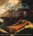
The Illustrated Longitude

Book description
The Illustrated Longitude recounts in words and images the epic quest to solve the greatest scientific problem of the eighteenth and three prior centuries: determining how a captain could pinpoint his ship's location at sea. All too often throughout the ages of exploration, voyages ended in disaster when crew and…
Why read it?
1 author picked The Illustrated Longitude as one of their favorite books. Why do they recommend it?

2500 years ago, Pytheas, a clever Greek explorer, figured out latitude.
While there has always been a concept of longitude, it proved impossible to pinpoint, until... Sobel and Andrewes engagingly unravel the cipher of longitude that was cracked by the plucky John Harrison (he created the right tool, a clock that kept accurate time at sea: why is this important? Read the book!).
Convinced that the solution could only be astronomical, the scientific community was not amused. It was a dramatic conflict between the skeptical Board of Longitude (probably also jealous) and the skilled workaday carpenter-turned-clockmaker whose solution to navigation’s…
From Georgia's list on how to read maps.
If you love The Illustrated Longitude...
Want books like The Illustrated Longitude?
Our community of 12,000+ authors has personally recommended 100 books like The Illustrated Longitude.

